Ponhea Lueu District (Popnhea Lueu)
Ponhea Lueu District (ស្រុកពញាឮ) is a district (srok) of Kandal Province, Cambodia. The district is subdivided into 14 communes (khum) such as Chhveang, Chrey Loas, Kampong Luong, Kampong Os, Kaoh Chen, Phnum Bat, Ponhea Lueu, Ponhea Pon, Preaek Pnov, Preaek Ta Teaen, Phsar Daek, Samraong, Tumnob Thum, Vihear Luong and 141 villages (phum). In the northern part of the district, near the border between Kampong Speu and Kampong Chhnang is the old royal capital of Oudong.
Map - Ponhea Lueu District (Popnhea Lueu)
Map


Country - Khmer_Republic
 |
 |
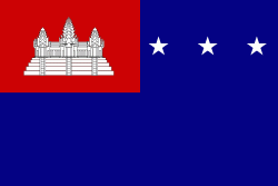
| Flag of Cambodia | |
The main cause of the coup was Norodom Sihanouk's tolerance of North Vietnamese military activity within Cambodia's borders; Vietnamese communist forces had gained de facto control over vast areas of eastern Cambodia as a result. Another important factor was the dire state of the Cambodian economy, an indirect result of Sihanouk's policies of pursuing neutrality.
Currency / Language
| ISO | Currency | Symbol | Significant figures |
|---|---|---|---|
| KHR | Cambodian riel | ៛ | 2 |
| ISO | Language |
|---|---|
| KM | Central Khmer language |
| EN | English language |
| FR | French language |